The 9 week studio took off from the global appetite and dependency on metals and minerals, and related it to national initiatives and strategies for mineral extraction as they now are in the making in Northern Norway. During 2012 the Norwegian government will present its own mineral strategy. The studio aimed to unfold the social, legal and environmental implications of an increased extraction seen through the lenses of the landscape architect. Through the themes The Big Picture, the Perforated Landscape, the Multi Layered Landscape, and a collection of individual Reflections the studio discovered how a new version of the territory are being mapped, described and conceived. Mining doesn’t only denote big profits; its industry also entails large scale impacts on landscape, nature and society. The notion of actuality, on taking part in the debate and acting in the world while things are happening discusses the landscape architects agency in taking part in the shaping of futures.
DET STORE BILDET
Studioets første fase fokuserer på kartlegging av gruvedriftens globale
systemer gjennom å bygge opp et atlas.
Vi studerer drivkreftene bak gruvedrift, det økende ressursforbruket,
mineralnæringens globale nettverk og infrastruktur og ser på hvordan dette utspiller seg i sirkumpolare
områder.
Open publication - Free publishing - More exploitation
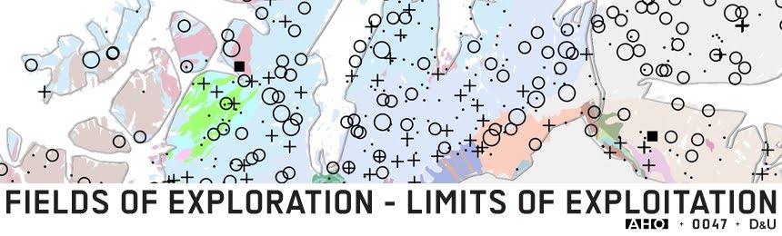
THE BIG PICTURE
The first phase of the
course is about mapping and building up an atlas
on the global system of mining.
We will study the forces
that drive mining, the increased resource consumption, mining’s global network
and infrastructure and how this plays out in the circumpolar areas.
DET PERFORERTE LANDSKAP
Den andre fasen bygger opp en katalog over gruvedriftens innvirkning
på landskapet, nye geologiske undersøkelser, forskjellige typer gruvedrift,
livssyklusen til en gruve og kortsiktige og langsiktige miljøpåvirkninger.
Open publication - Free publishing - More exploitation
THE PERFORATED LANDSCAPE
The second phase creates a catalogue on mining’s impact on the
landscape, study new geological surveys, modes of mining, the life cycle of a
mine and mining’s environmental impacts.
DET FLERPROGRAMMERTE LANDSKAP
I
denne fasen vil vi undersøke virkningen av gruvedrift på lokalsamfunn, den
overlappende arealbruk, lovverk og urfolksrettigheter og konkurrerende landskapsbruk
ved å lage et magasin med kronikker.
Open publication - Free publishing - More exploitation
THE MULTILAYERED LANDSCAPE
In this phase we will
examine the impact of mining on communities, the indigenous dimension, the
overlapping use of land, legislation and competing activities by making a magazine of chronicles.
REFLEKSJONER
Basert på kunnskapsinnhenting,
studiereise, samtaler og workshops med
kursets lærere og eksterne eksperter formulerer studentene sine refleksjoner sammensatt av de
kunnskapene som er tilført studioet. Kolleksjonen
viser bredden, dybden, muligheten og konsekvensene av dette nye nasjonale
initiativet i Nord-Norge.
(some reflections had big filesizes, so we had to divide the collection into 3 e boks)
(some reflections had big filesizes, so we had to divide the collection into 3 e boks)
Open publication - Free publishing - More exploitation
Open publication - Free publishing - More exploitation
Open publication - Free publishing - More exploitation
REFLECTIONS
Based on
research, study travel, conversations and workshops with course teachers and
external experts, the students formulate reflections composed of the knowledge
acquired during the studio. The
collection shows the breadth, depth, possibilities and impacts of this new
national initiative in Northern Norway.


